NAMIBIA: New 3D GeoStreamer Seismic Data in Northern Namibe Basin
The 1 532 sq. km ANG BLK27 Namibe 3D GeoStreamer survey expands PGS’ seismic coverage in the Angolan sector of the basin to over 26 500 sq. km of continuous 3D broadband data. This expansion allows play elements to be mapped in an enlarged basin framework, enabling the identification of sweet spots and derisking exploration.
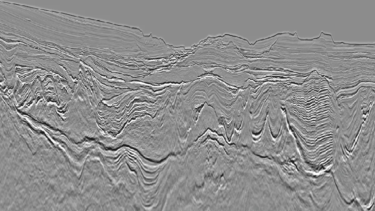
The data, which have undergone modern processing techniques including FWI and tomographic velocity model building, reveal the geological complexity of the northern Namibe Basin, including significant lateral variations in mobile salt presence and thickness. Target plays have been identified in the presalt with further potential in the post-salt Upper Cretaceous/Tertiary section.

Final KPSDM line from the ANG BLK27 Namibe 3D GeoStreamer survey showing structuration and pinch-out geometries in the presalt, post-salt mini-basin fill and shallower channelized sequences.


